
Township 22 North, Range 5 East — Historical Map
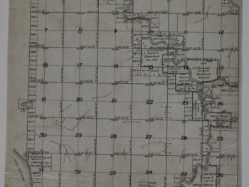
This historical map of Kent, Washington Township Map circa 1890s is offered as an original tracing copy from Surveyor General.
The map’s listed title is Township 22 North, Range 5 East. This is a historical tracing copy of the 1861 Surveyor General Township map of Kent, Washington. Copy was produced in the 1890’s.
The township format offers a useful point of comparison with other survey maps in a collection. Its survey references help distinguish this sheet from a general city map and connect it with the practical mapping of land.
Map size: 13″ x 14″
Condition: Good. Review the photographs for the appearance of this particular item.