Description
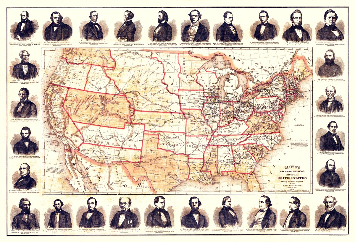
‘Lloyd’s American railroad map of the United States’
This United States railroad map depicts the three proposed roads and the overland mail route to the Pacific Ocean. It also shows drainage, state boundaries, major cities, forts, finished and other proposed railroads. The portraits of 28 railroad presidents are reproduced in the border. Drawn by James T. Lloyd and Rae Smith, published in New York in 1859.
Reproduction Size: 36″x 25″ (91.5cm x 63.5cm)