Description
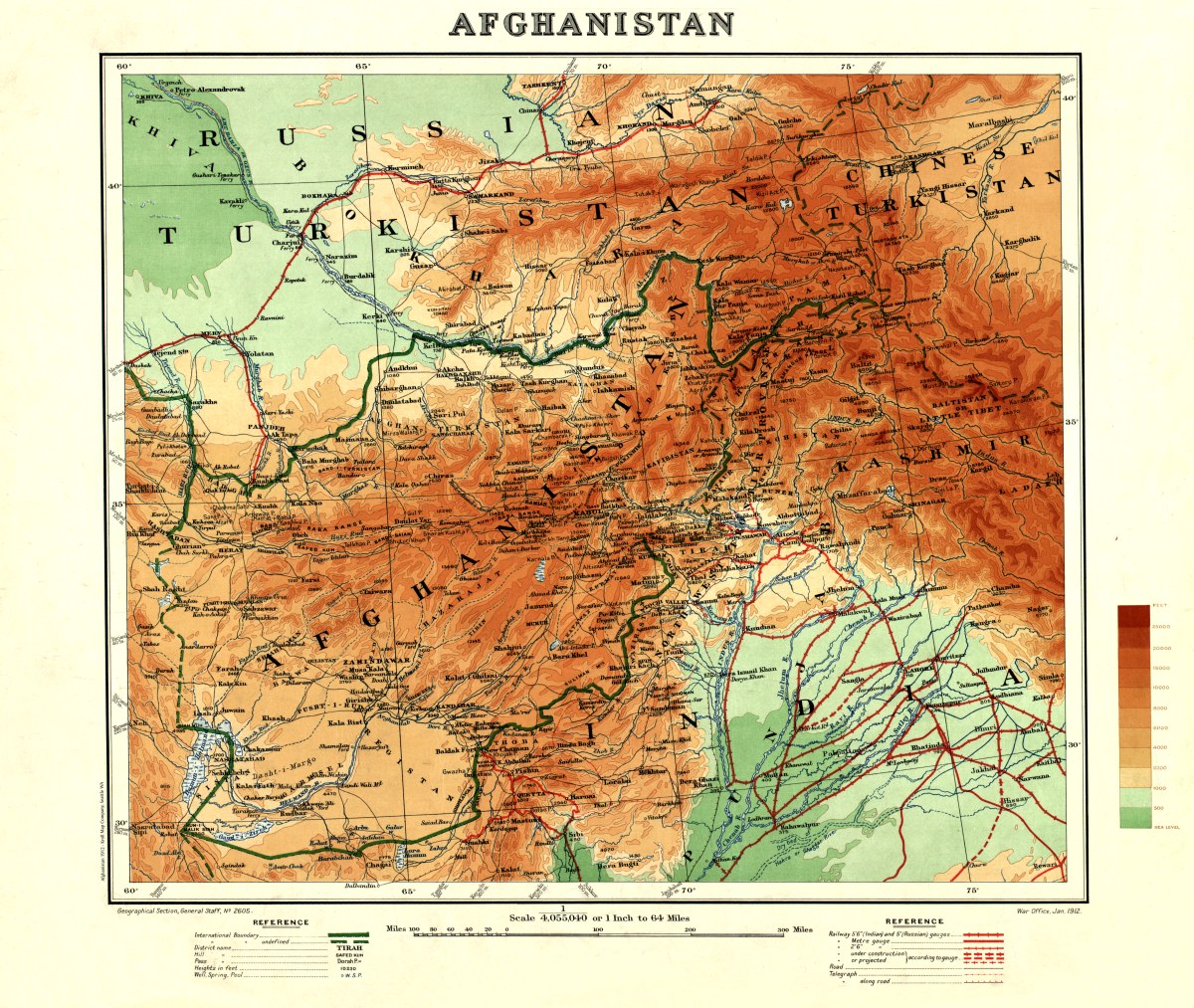
‘Afghanistan’
This antique map of Afghanistan was produced by the Geographical Section of the General Staff of the British Army and issued by the War Office in London in January 1912. It gives the names and locations of districts, mountains, passes, and sources of water. Relief is shown by contours and heights are given in feet. Colors, as explained in the key on the right side of the map, are used to indicate altitude, with the heights shown ranging from sea level to 25,000 feet (7,620 meters) and higher. The map devotes particular attention to transportation and communications networks in the parts of British India and the Russian Empire adjacent to Afghanistan. Railroads (both operational and under construction or planned) are marked, with the different Russian and Indian gauges indicated with different lines and symbols. Also shown are roads and telegraph lines.
Reproduction Size: 36″x 31″