Description
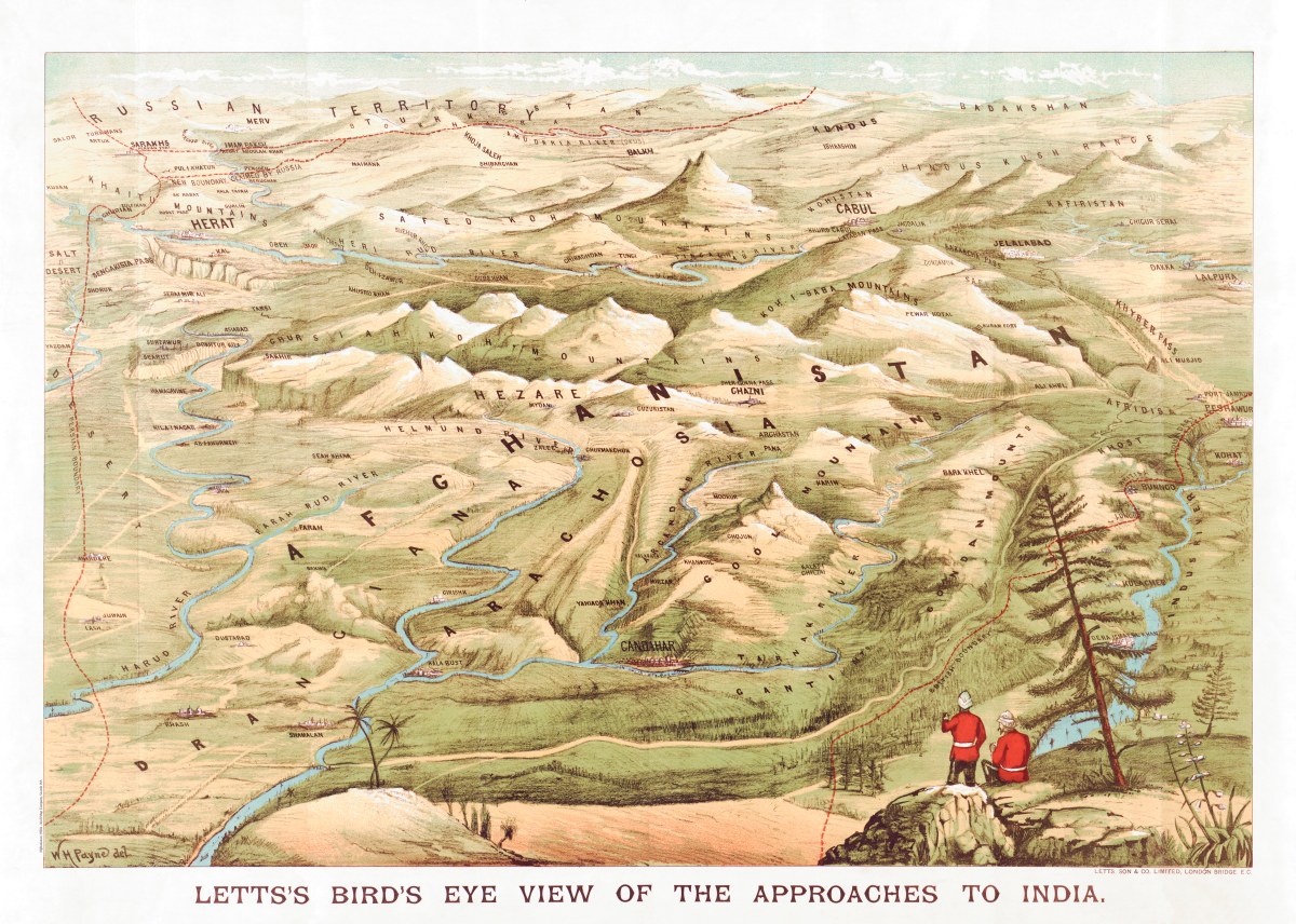
‘Letts’s bird’s eye view of the approaches to India’
This panoramic map dramatizes the approaches to British India through Afghanistan by offering a bird’s-eye view of the mountainous territory between the then-Soviet Union and the Indus River valley (present-day Pakistan). The map was produced, probably in the 1920s, by Letts Stationers. The map was intended for hobbyists who, as advertised, could buy for six pence a packet of flags for sticking into the map to plan or follow military movements. In the foreground are two British soldiers in uniform, overlooking the Indus River. Geographic features seen in the distance below include the Khyber Pass, the city of Jalalabad, the Amudarya River that formed part of the border between Afghanistan and the Soviet Union, the Murgab River in present-day Turkmenistan, and the disputed border between Russia (i.e., the Soviet Union) and Afghanistan. Fear of a Russian attack on India through Afghanistan was a major influence on British strategic planning in the 19th century, and one that persisted into the first half of the 20th century
Reproduction Size: 36″x 26″