1912 Afghanistan Railroad and Elevation Map
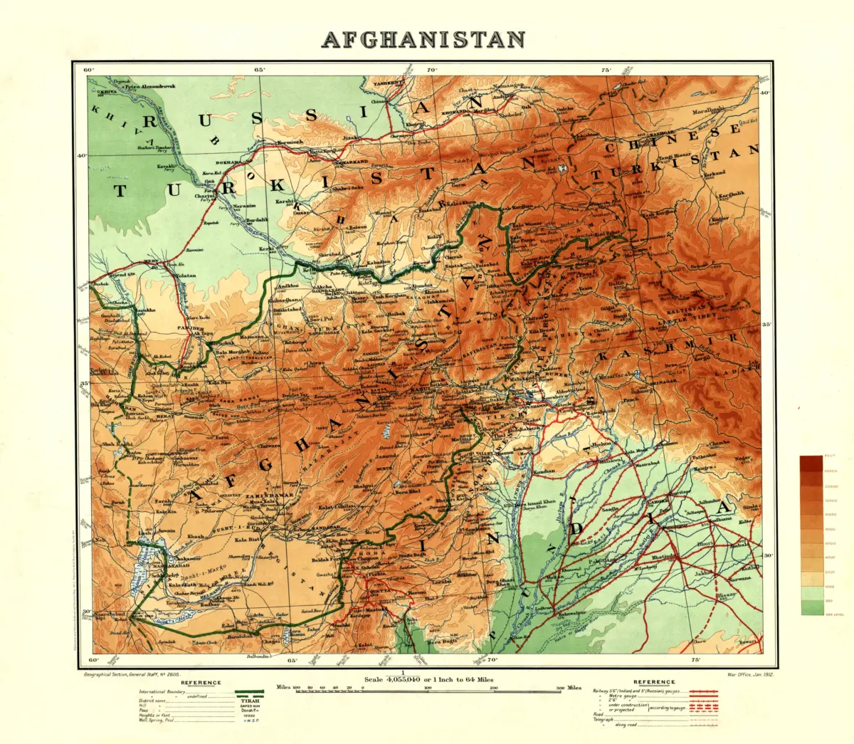
This Afghanistan and Pakistan map print reproduces a 1912 map prepared by the British Army’s Geographical Section, General Staff, and issued by the War Office. Originally titled Afghanistan, it also covers neighboring territories, including areas of British India that are now part of Pakistan.
The map identifies districts, mountain passes, and water sources. Contours, spot heights in feet, and a color elevation key distinguish lowlands from terrain reaching 25,000 feet and above.
Transportation and communications are a particular focus. Symbols distinguish railway gauges and lines operating, under construction, or proposed; roads and telegraph routes also appear. Warm orange mountain shading, green lowlands, and red rail lines give this historical map a distinctive visual character.
Printed size: 36″ × 31.4″