Alaska Excursion Steamers and the Inside Passage, 1891
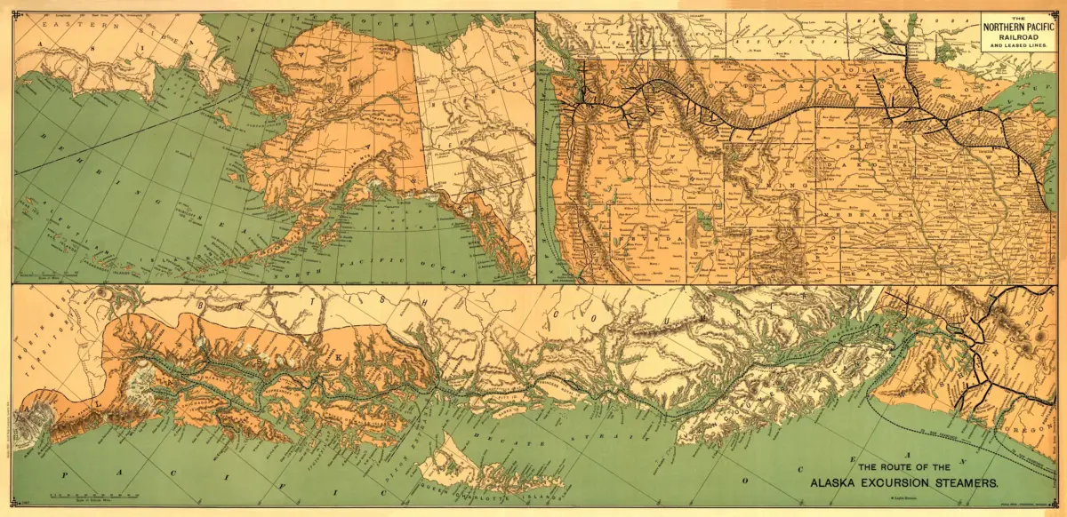
This 1891 Alaska map print reproduces The Route of the Alaska Excursion Steamers, credited by the Library of Congress to Charles S. Fee. It traces a travel network that linked northern scenery with steamship and railway journeys.
The sea route heads north from the Puget Sound area, passing east of Vancouver Island toward Alaska. Connecting railway routes extend the story inland, showing how travelers from places such as Chicago could begin their journey on the Great Northern and Northern Pacific lines.
Ancillary maps place the excursion within the wider geography of Alaska and the northwestern states. Follow the connections across the sheet to see how a travel map could turn a distant destination into a sequence of recognizable routes.
This reproduction is an appealing piece for collectors of Inside Passage maps, railway history, and early Alaska tourism. Its broad composition makes it especially suited to a display alongside other maritime travel maps.
Printed size: 36″ × 18″