Kroll’s Alaska Cannery Map, 1948
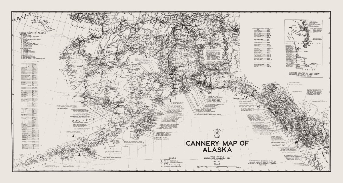
This Alaska cannery map print reproduces the original map drawn in 1948 by Ed Poland, Kroll Map Company’s chief cartographer. Its focus on fishing areas and canneries offers a distinctive view of Alaska, connecting geographic detail with the places and facilities associated with the fishing industry.
Fishing district boundaries, towns, villages, and airplane landing fields appear alongside indexes of canneries, including salmon canneries. These practical details reward close inspection, making the map an engaging piece for anyone interested in Alaska’s fishing history or specialized commercial cartography.
An inset extends the map’s coverage to canneries on Puget Sound, the Washington coast, the Columbia River, and the Oregon coast. That broader perspective links Alaska with other Pacific Northwest fishing and cannery locations in a single historical composition.
Sold as a map print, this reproduction preserves the character of Kroll’s original 1948 drawing. Choose a sepia-tone or blueline-tone print; the photograph shows the sepia version.
Printed size: 36″ × 19.1″