Description
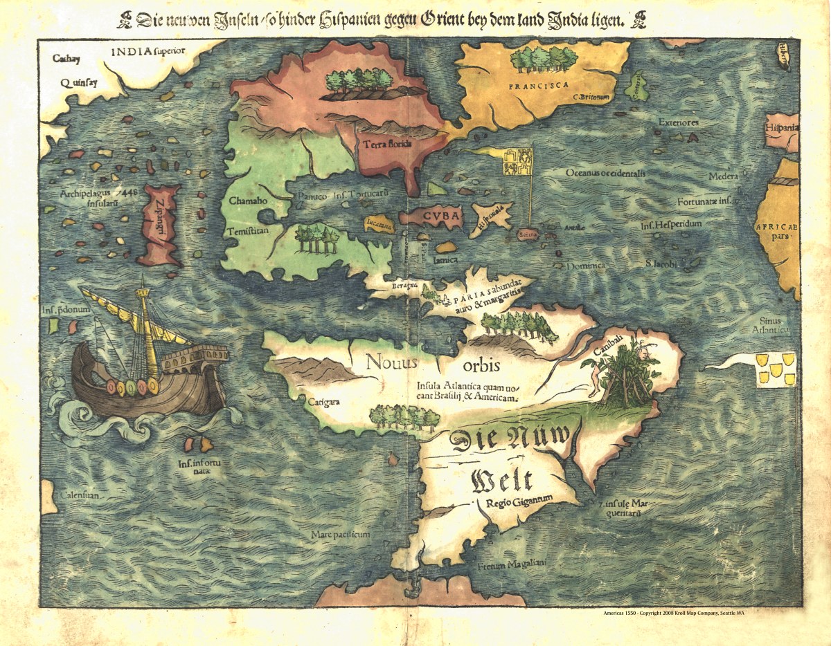
‘Die neuwen Inseln, so hinder Hispanien gegen Orient bey dem land India ligen’
This “New World or Islands” is a captivating cartographic work of historical significance. Created by Sebastian Münster in Basel, Switzerland, around 1550, this map is a testament to the early European exploration and understanding of the Western Hemisphere. Richly detailed and aesthetically pleasing, this map illustrates the Western Hemisphere during the Age of Discovery. While South America is labeled in German, the rest of the geographic features are described in Latin. This linguistic duality reflects the intersection of cultures and the quest for knowledge during the era.
The map is a part of Münster’s renowned work, ‘Cosmographei’, and it provides a fascinating glimpse into how Europeans perceived and visualized the New World before the vast scope of its lands and cultures was fully understood. Intriguingly, this historical map was exhibited as part of ‘Rivers, edens, empires: Lewis & Clark and the revealing of America’, highlighting its role in early exploration and the ongoing quest to unveil the mysteries of the New World.
Reproduction Size: 34″x 29″


