Description
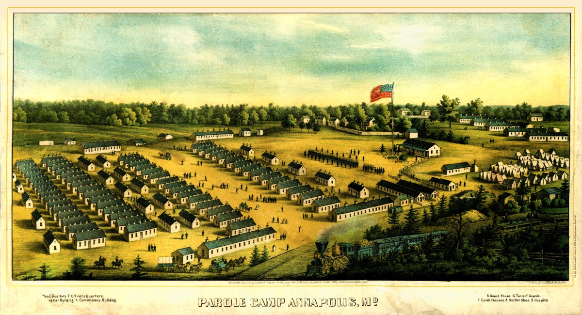
‘Parole Camp Annapolis, M’d.’
This map offers a fascinating glimpse into the history of Parole and Annapolis, Maryland, during the Civil War era in 1864. Created and published by E. Sachse & Co. in Baltimore, this historical cartographic piece provides a valuable visual representation of this significant period.
The map is a combination of bird’s-eye views and aerial perspectives, showcasing the layout of military camps in Parole and Annapolis. It delves into the Civil War history of these areas, highlighting key points of interest. The inclusion of an index adds an informative dimension, aiding in navigation and interpretation of the map.
This work is not only a testament to the craftsmanship of E. Sachse & Co. but also a historical document that captures the intricacies of Parole, Annapolis, and the surrounding regions during a crucial moment in American history. The map’s publication in 1864, as noted by its copyright statement, adds to its significance as a primary source for understanding the past.
Reproduction Size:
36″x 32″