Description
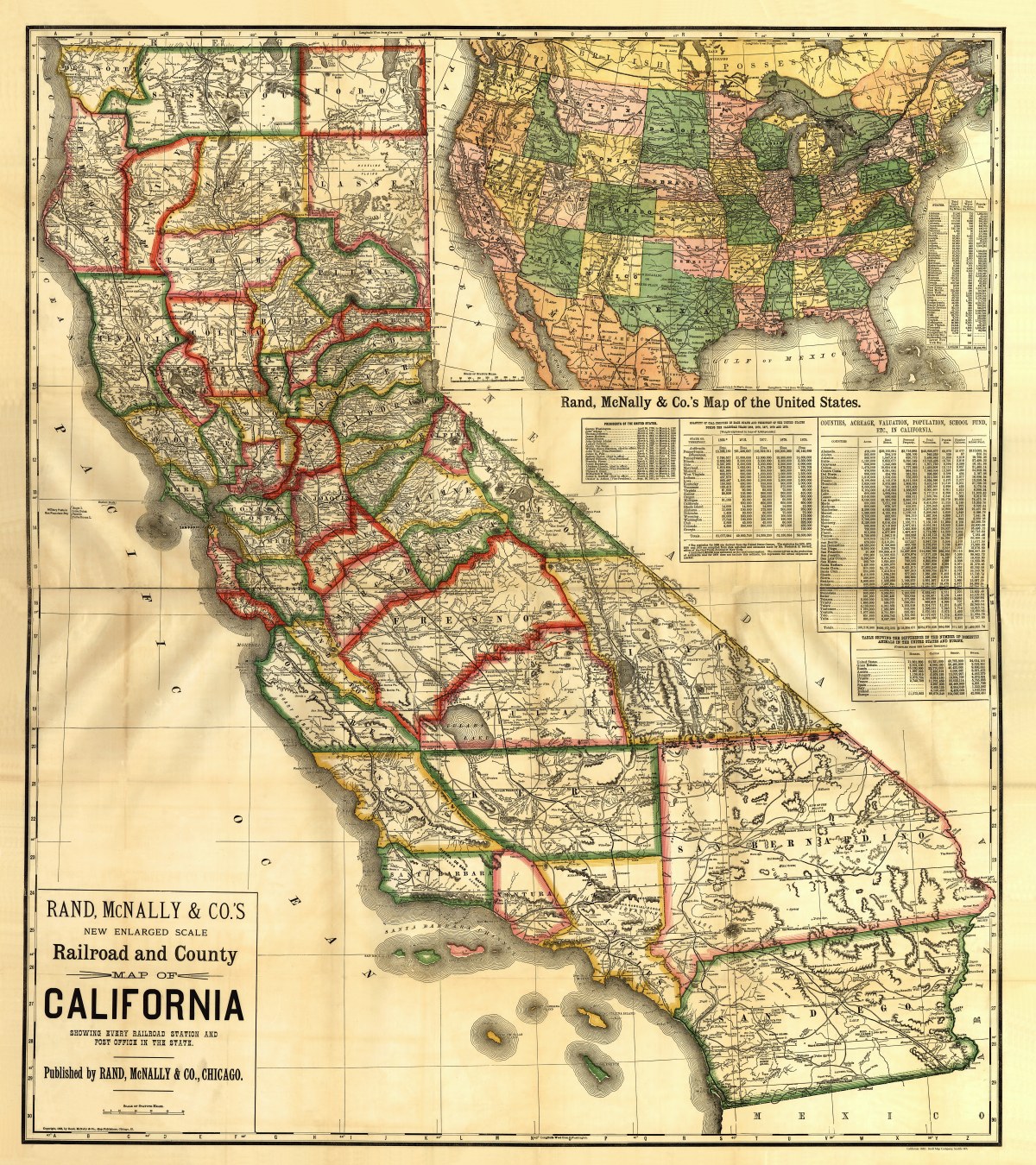
‘New enlarged scale railroad and county map of California showing every railroad station and post office in the state’
A wealth of interesting information on this colorful Rand McNally map published in 1883- all railway lines, counties, and post offices in California, as well as relief shown by hachures, drainage, cities and towns, counties, roads, and several tables and indexes. There are tables showing the difference in the number of domestic animals in the United States and Europe, the quantity of coal produced in each state and territory, and a list of United States Presidents, and other info- because you need to know. Large inset map of the contiguous United States that includes railway lines.
Reproduction Size: 31″x 36″