Description
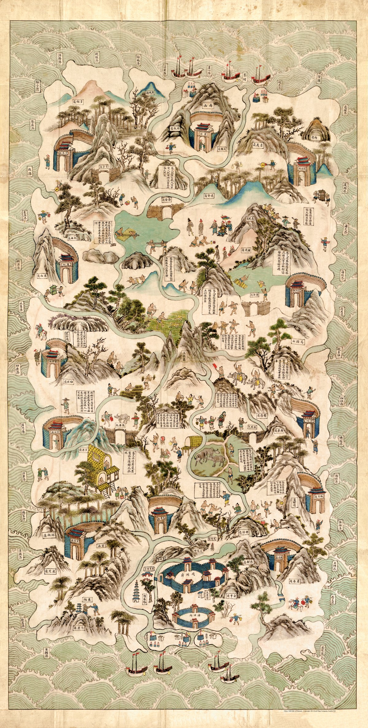
‘Qiong Jun di yu quan tu’ or ‘瓊郡地與全圖’
‘Hainan Dao tu shuo’, or ‘complete map of Hainan Island’ was created in 1920. This colorful pen-and-ink and watercolor map depicts the social life and customs of the Li tribes in the central part of Hainan Island. Relief is shown pictorially with north oriented at the bottom with several descriptive notes. Chinese-language map.
Reproduction Size: 18.3″x 36″