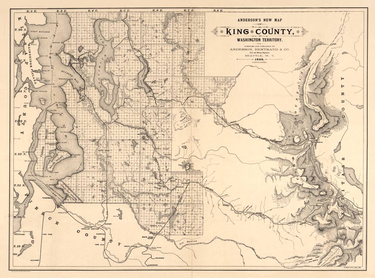
Description
‘Anderson’s new map of King County, Washington Territory’
This cadastral map of land ownership map in King County, Washington covers the entire county, from Puget Sound to the Cascade Mountains. It notes several resident names, section, township, and range grid and beautifully rendered relief. Drawn by Anderson, Bertrand & Co.
Reproduction Size: approx. 30″x 22.5″