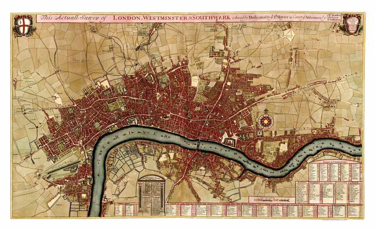
Description
‘London, Westminster & Southwark’
This beautiful survey map of London and surrounding area was created by Phillip Lea and Christopher Browne in 1709. It contains tables of the public offices, markets, halls, prisons, palaces, hospitals, the names of the 26 wards, and “the parishes within the walls which before the fire of 1666 were 97 since which some of them are united, churches now 62”.
Reproduction Size: approx. 36″x 22″