Pacific Highway: Vancouver B.C. to San Francisco — Historical Map
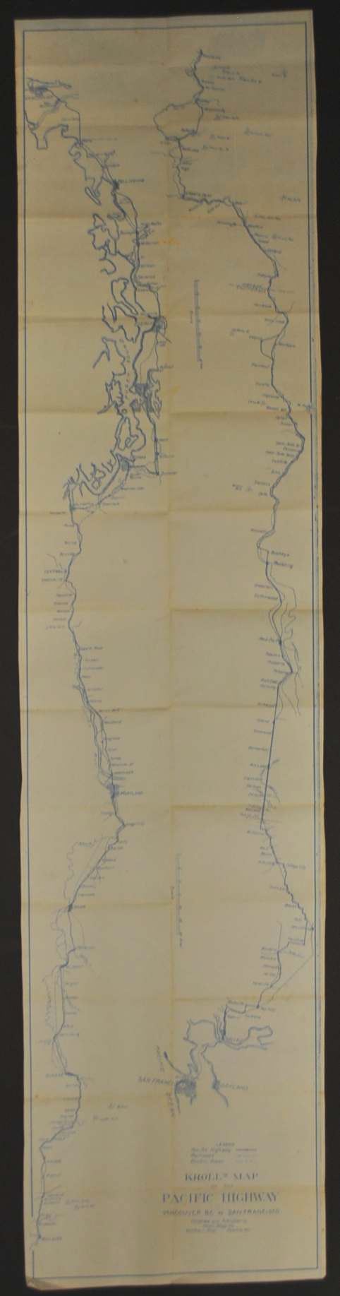
This historical map of Pacific Highway Map circa 1920’s is offered as an original blueprint from Kroll Map Company.
This narrow, elongated Pacific Highway blueprint follows the route from Vancouver, British Columbia, to San Francisco, California. At 12″ × 53″, its unusual proportions reinforce the appeal of a map organized around a long journey rather than a single city or county.
Explore it alongside later maps to compare the ways publishers presented routes and places to their readers. Its value as a historical object lies in both the mapped area and the format chosen for everyday reference.
Map size: 12″ x 53″
Condition: Good, previously folded. Review the photographs for the appearance of this particular item.