Description
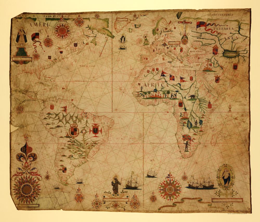
A portolan chart of the Atlantic Ocean and adjacent continents
This untitled map circa 1633 shows the southeast Pacific Ocean, the southwest Indian Ocean, as well as the continents of South America, Africa, Europe, and portions of North America and Asia. Drawn by Pascoa Roiz with pen-and-ink and watercolor, relief is shown pictorially and includes pictures of a fort, circle of compass roses, flags, insignia, coast-of-arms, and religious figures.
Reproduction Size: 36″ x 30.5″


