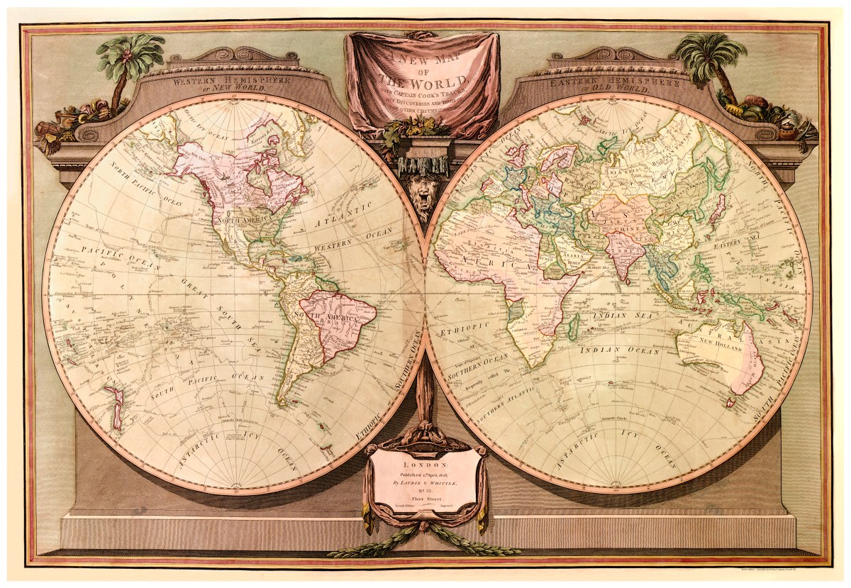
Description
‘A New Map of the World, with Captain Cook’s Tracks, His Discoveries and Those of the Other Circumnavigators’
Elegantly bordered map created by Robert Laurie and James Whittle in London, England in 1808. The relief is shown pictorially and by shading and hand-colored. Shows the paths and dates of Capt. Cook’s travels and returns, among others.
Reproduction Size: 36″x 25″