Description
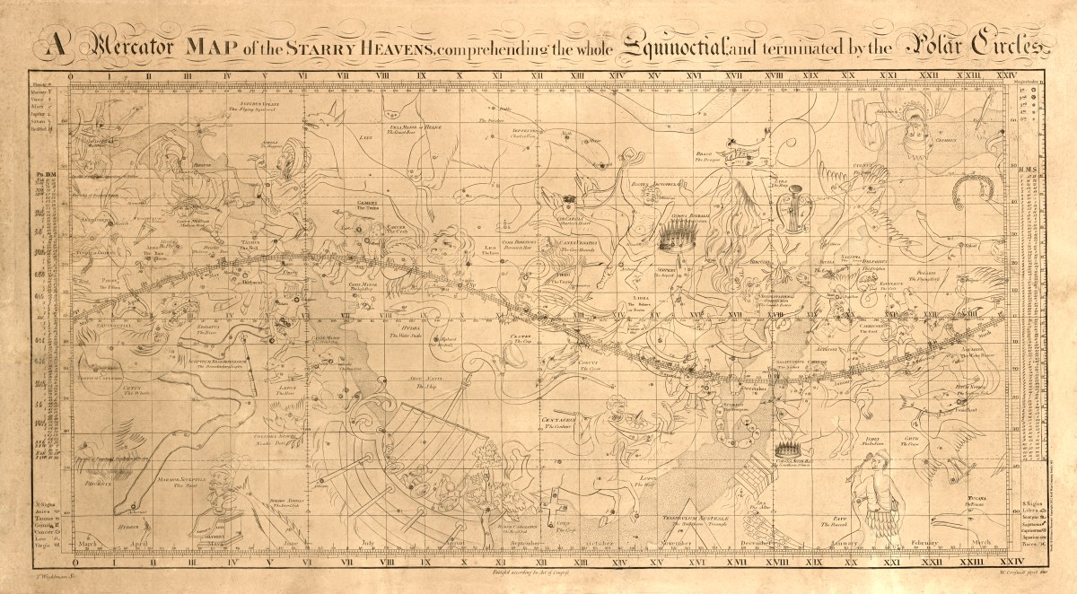
‘A Mercator map of the starry heavens : comprehending the whole equinoctial and terminated by the polar circles’
William Croswell and Thomas Wightman contributed to and published this ‘heavenly’ celestial pen-and-ink map in Boston, Massachusetts in 1810. It shows the path of the Great Comet of 1807, several planets, and the introduction of two constellations: Sciurus Volans (Flying Squirrel) and Marmor Sculptile (Bust of Columbus).
Reproduction Size: 36″x 20″ (91.5cm x 51cm)