Description
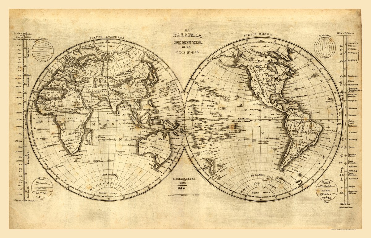
‘He mau palapala aina, a me na niele e pili ana. Hookahi ke pai ana’
Hawai’ian language map of the world created/published in Lahaina-luna, Maui, in 1839. This pen and ink map of the hemispheres (“Poepoe Komohana” and “Poepoe Hikina”) has illustrations of meridians, scales, and a chart showing the principal mountains and volcanos of the world.
Reproduction Size: 30″x 19.5″ (76cm x 49.5cm)