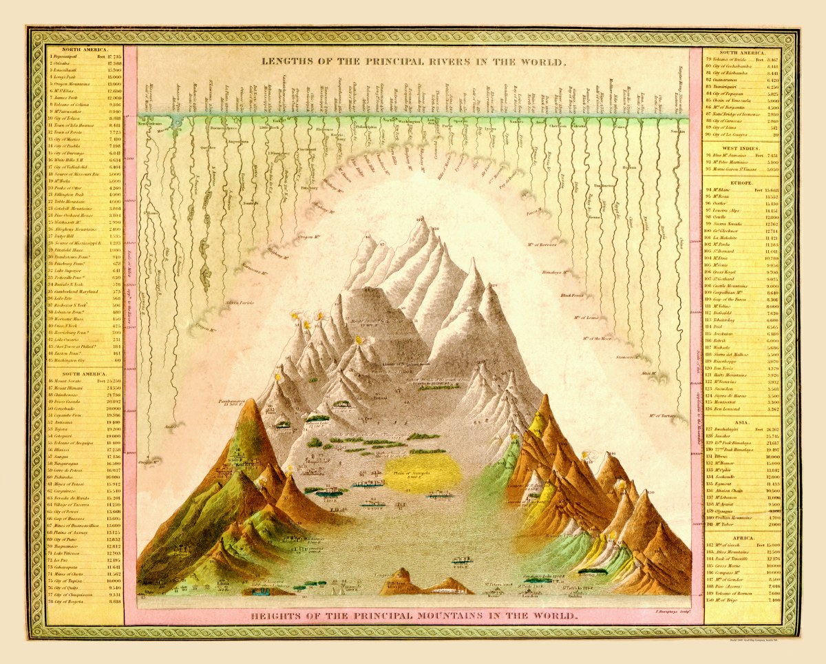
Description
‘Lengths of the Principal Rivers of the World, Heights of the Principal Mountains in the World’
A truly unique and beautifully drawn map chart by Samuel Augustus Mitchell in 1849, depicting the principal mountains and rivers of the world with their lengths and heights in the sidebar indexes.
Reproduction Size: 23″x 18″ (58.5cm x 46cm)