Description
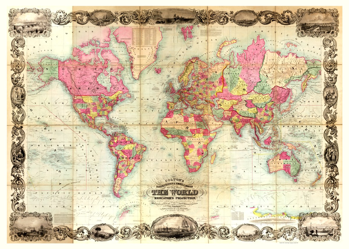
‘Colton’s illustrated & embellished steel plate map of the world on Mercator’s projection : compiled from the latest & most authentic sources exhibiting the recent Arctic and Antarctic discoveries & explorations’
Contributors Johnson and D. Griffing created and published this colorful map in New York in 1854. It includes illustrations of cities and people along a filigreed border and has an inset of a view of the Antarctic Continent as seen by the U.S. Ship Peacock, January 19th, 1840. There’s a handy list of distances to and from various cities around the world and an explanations of projection and scale.
Reproduction Sizes:
36″x 26″ (91.5cm x 66cm)
43″x 31″ (109cm x 79cm)