Description
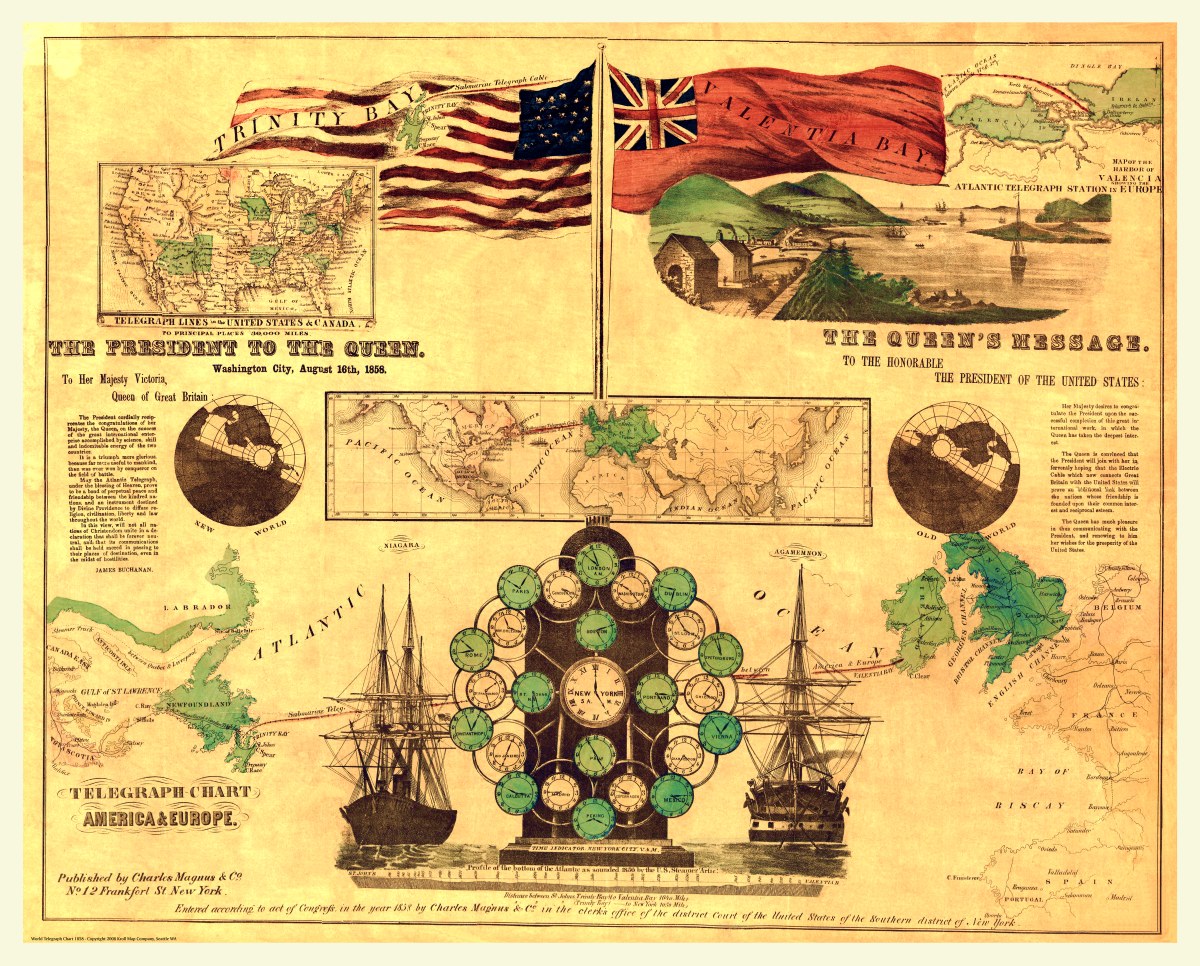
‘Telegraph chart, America and Europe’
Charles Magnus & Co. is the maker of this intriguing hand-colored chart and map depicting the route and depth of underwater telegraph cable across the Atlantic Ocean from Trinity Bay to Valentia Bay in 1858. Published in New York. Several illustrations are depicted as well as the President’s and the Queen’s messages to one another on August 16th.
Reproduction Size: 36″x 29″ (91.5cm x 73.5cm)