Description
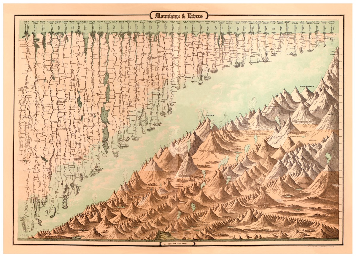
‘Mountains and Rivers’ from Johnson’s new illustrated family atlas’
Alvin Jewett Johnson and J.H. Colton contributed to this informative chart that was published in New York in 1862. This is a unique piece in that it lists pictorially the earth’s major rivers’ origins, lengths, and endpoints- with lakes and cities along the way. It also shows the world’s tallest mountains by continent including height and volcanic activity. Index included.
Reproduction Size: 30″x 22″ (76cm x 56cm)