Description
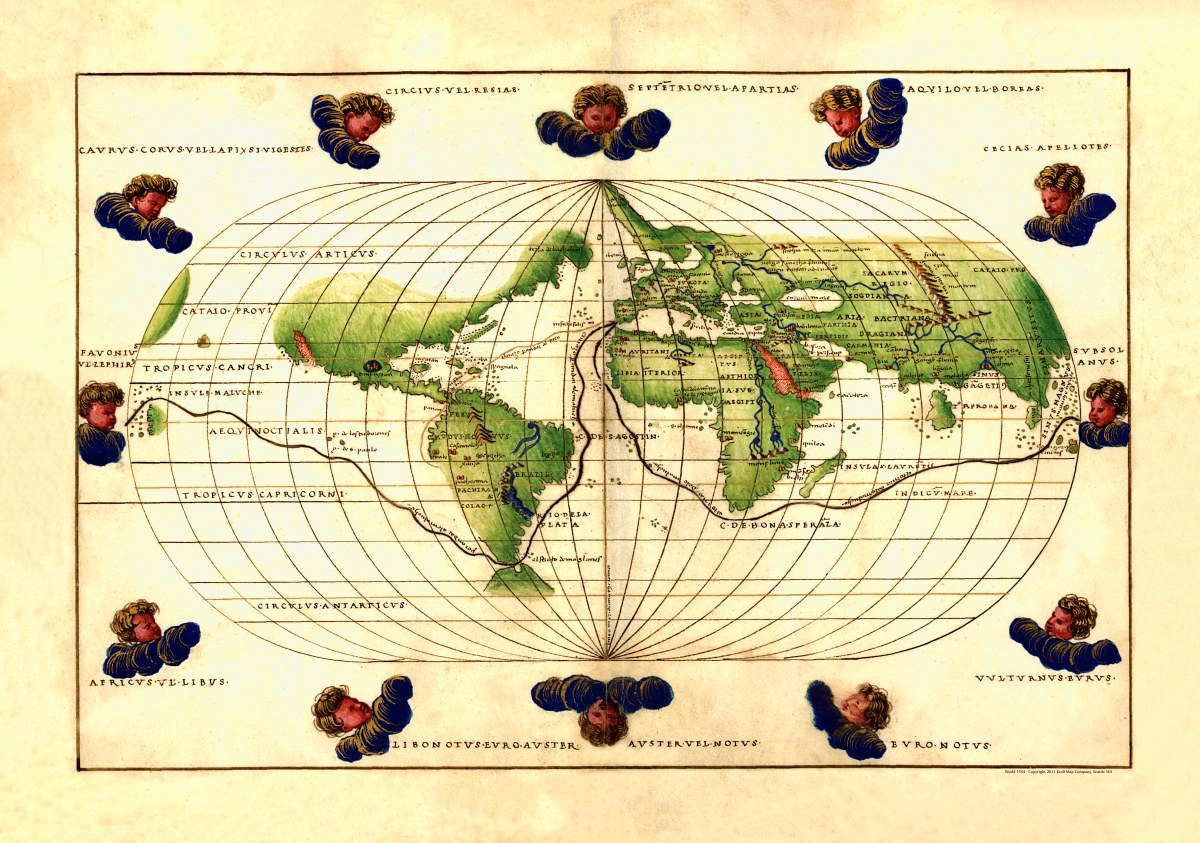
Untitled
This untitled world map is from a portolan atlas, drawn by Battista Agnese and dedicated to Hieronymus Ruffault, Abbot of St. Vaast circa 1544. The manuscript is pen-and-ink and watercolor on vellum and shows Magellan’s route around the world and a route from Spain to Peru. The 12 wind cherubs on this map are named.
Cartographer’s Note: Portolan (or portulan) charts are maps based on compass directions and estimated distances
observed by navigators at sea (first charts created in the 13th century) and were prized for their cartographic accuracy- even considered state secrets by some nations. Portolan maps all share the characteristic rhumblines (windrose lines), which radiate from compass roses located at various points on the map. These represent lines of bearing, but are not modern rhumb lines or meridians.
Reproduction Size: 36″x 25.5″ (91.5cm x 65cm)