Description
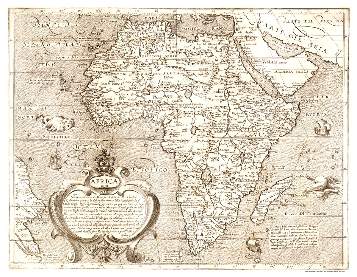
‘Africa’
This beautifully-illustrated map was created by Arnoldo di Arnoldi and Matteo Florimi and published in Siena, Italy in the early 1600s. It includes notes and fanciful illustrations of several sailing ships and sea monsters throughout, with the accurate port information typical of Italian cartographers of the time period.
Reproduction Size: 36″x 28″ (91.5cm x 71cm)