Description
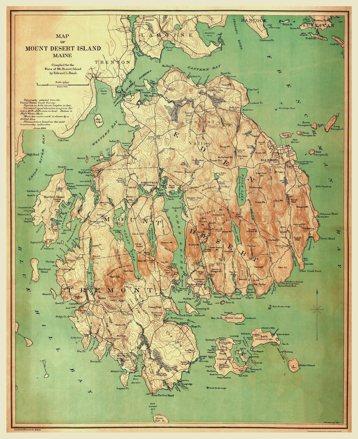
‘Map of Mount Desert Island, Maine’
Compiled for the flora of Mt. Desert Island by W.H. Monroe and Edward L. Rand in June 1893.
From the map: “Topography was adapted from the United States Coast Survey. Figures on hills denotes heights in feet. Curves of equal elevation are given for every 20 ft. difference in level. Datum is High Water Mark. Mean low water mark is shown by a dotted line. Nomenclature based on the most trustworthy authorities.”
Reproduction Size: 29.5″x 36″ (75cm x 91.5cm)