Description
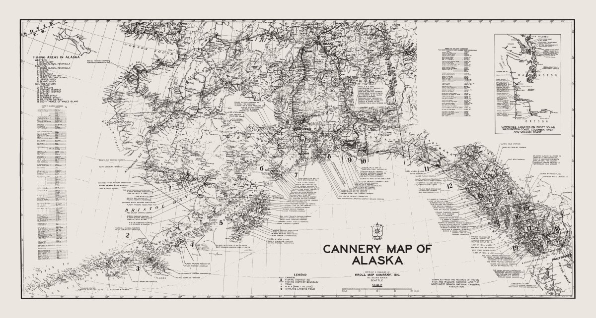
‘Cannery Map of Alaska, 1948’
Kroll Map Company’s historically popular map of fishing areas and canneries of Alaska with an inset map of canneries located on Puget Sound, Washington Coast, Columbia River and Oregon coast shows fishing district boundaries, towns and villages and airplane landing fields. Indexes of canneries (and specifically salmon canneries) are also included. Created by our Chief Cartographer Ed Poland in 1948. Sepia print or blueline print available. (Sepia map shown above.)
Reproduction Size: 66″x 35″