Description
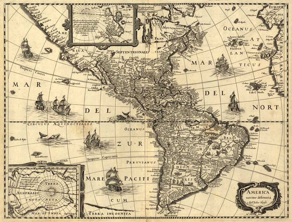
‘America noviter delineata’
This pictoral relief map translates to ‘America newly delineated’ and was created about 1642, attributed to Jodocus Hondius, Hugues Picart, and was published in Paris by Jean Boisseau.
The map’s main focus is the Western Hemisphere, providing a comprehensive view of North and South America. It is adorned with intricate details and features, exemplifying the cartographic style of the time. The map exhibits relief through pictorial representation, offering viewers a sense of the continent’s topography. Additionally, ‘America noviter delineata’ includes insets depicting the North and South Polar regions. These insets provide further insight into the world as it was understood in the 17th century.
Reproduction Size: 28″ x 21.5″