Description
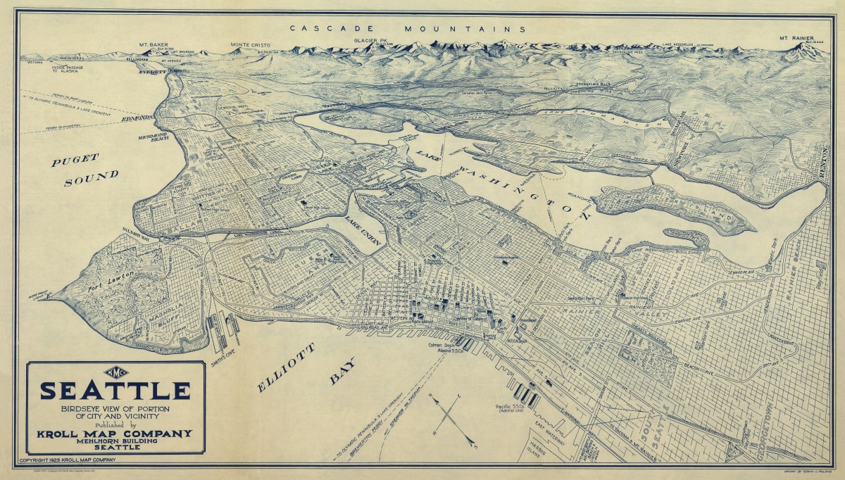
‘Seattle- Birdseye View of Portion of City and Vicinity’
This classic map of the Pacific Northwest was drawn by Kroll Map Company’s longtime Chief Cartographer Edwin Poland in 1925. It shows neighborhoods, ferry routes, major streets, and some surrounding towns. In the background is a wonderful illustration of the Cascade Mountains with Mount Rainier, Glacier Peak, Mount Baker and a few others labeled.
This captivating perspective map, created in 1925 by Edwin C. Poland at the Kroll Map Company, offers a mesmerizing glimpse into the heart of Seattle, Washington. A true relic of history, it provides a unique bird’s-eye view of this bustling metropolis at a time when it was evolving rapidly. With its orientation towards the upper left, this map allows us to explore the city’s diverse neighborhoods, industrial zones, and vibrant waterfront, giving us a true sense of the era’s character.
The map’s artistry and attention to detail are remarkable. It provides a profound sense of history, depicting the architectural grandeur of the time, and the bustling activity of this important Pacific Northwest city. A true masterpiece of cartography, this vintage perspective map offers a window into Seattle’s past, inviting us to explore the city and its surroundings in a way that only the artists and cartographers of the Kroll Map Company could provide.
Size: 36″x 20″ (91.5cm x 51cm)