Description
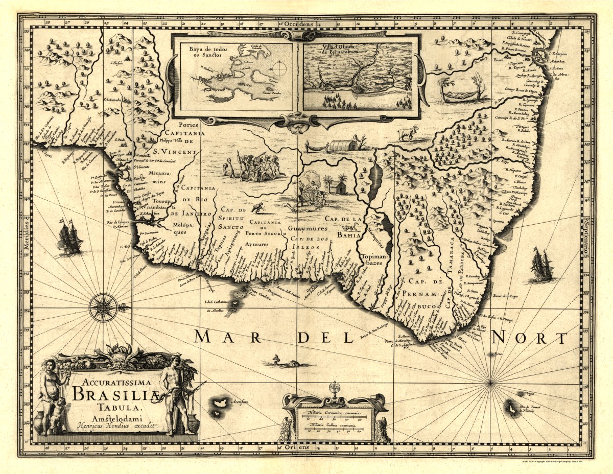
‘Accuratissima Brasiliæ tabula’
Hendrik Hondius created this portolan-type map of Brazil in 1630. Relief is shown pictorially with north oriented to the right and several small illustrations. Includes insets of “Baya de todos os Sanctos” and “Villa d’Olinda de Pernambuco”.
Reproduction Size: 36″x 28″ (91.5cm x 71cm)