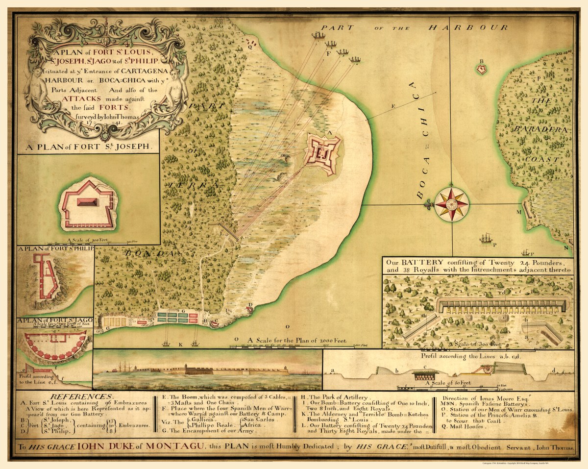
Description
‘A plan of Fort St. Louis, St. Joseph, St. Jago & of St. Philip scituated [sic] at ye entrance of Cartagena Harbour or Boca-Chica with ye parts adjacent and also of the attacks made against the said forts’
John Thomas the Elder created this map of Cartegena, Colombia for his grace Iohn Duke of Montagu in 1741. This pen and ink and watercolor map is drawn with north oriented to the left and includes an index, panoramic view, relief profile, and illustrations. The insets are a plan of Fort St. Joseph, a plan of Fort St. Philip, and a plan of Fort St. Jago.
Reproduction Size: 36″x 29″ (91.5cm x 73.6cm)