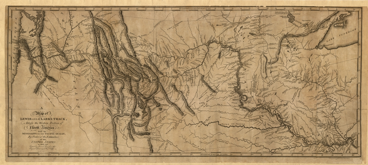
Description
‘A map of Lewis and Clark’s track, across the western portion of North America from the Mississippi to the Pacific Ocean’
Samuel Harrison created this detailed northwestern U.S. states map covering the western portion of Captains Lewis and Clark’s expedition from St. Louis Missouri to the mouth of the Columbia River.
Reproduction Size: 48″x 21.5″ (122cm x 55cm)