An 1889 Bird’s-Eye View of North Yakima
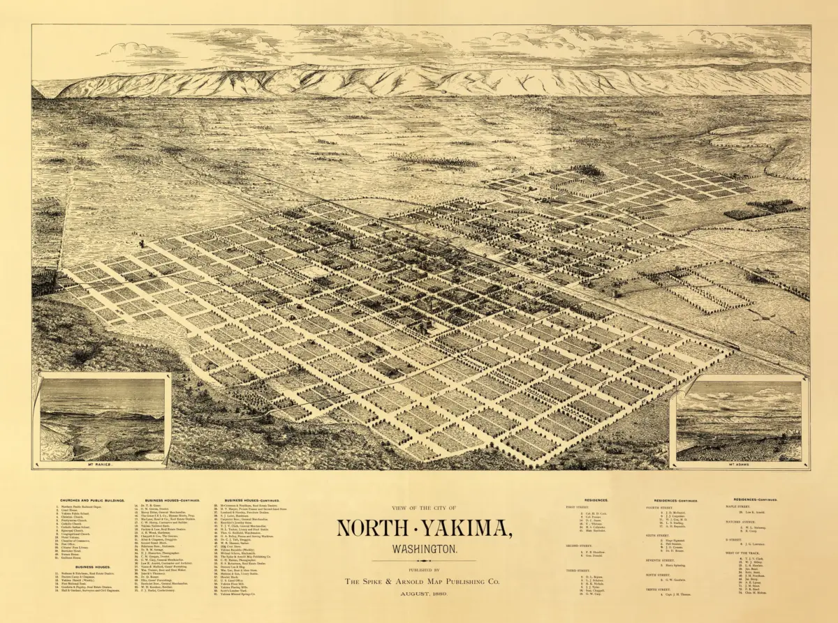
This 1889 Yakima map print offers a richly illustrated view of North Yakima, Washington, with streets and buildings spreading across an orderly town grid. Published by Spike & Arnold Map Publishing Co., the sheet gives everyday places a presence that a simple outline map cannot: railway tracks, homes, commercial buildings, and open land can all be explored in one scene.
The Library of Congress credits Syd W. Arnold and identifies the image as a bird’s-eye perspective map rather than a map drawn to scale. Its illustrations and numbered index help connect the panoramic view with specific points of interest, inviting viewers to move from the broad cityscape to individual landmarks.
Views of Mount Rainier and Mount Adams add a dramatic regional setting along the lower portion of the sheet. The soft sepia palette brings the architecture and surrounding countryside together, giving the print a warm appearance while preserving the intricate linework.
For a Yakima resident, a Washington history enthusiast, or anyone drawn to antique city views, this is a map with plenty to discover. Display it in a study or living space where its streets, skyline, and landmark key can be enjoyed up close.
Reproduction size: approximately 36″ × 26.8″