Description
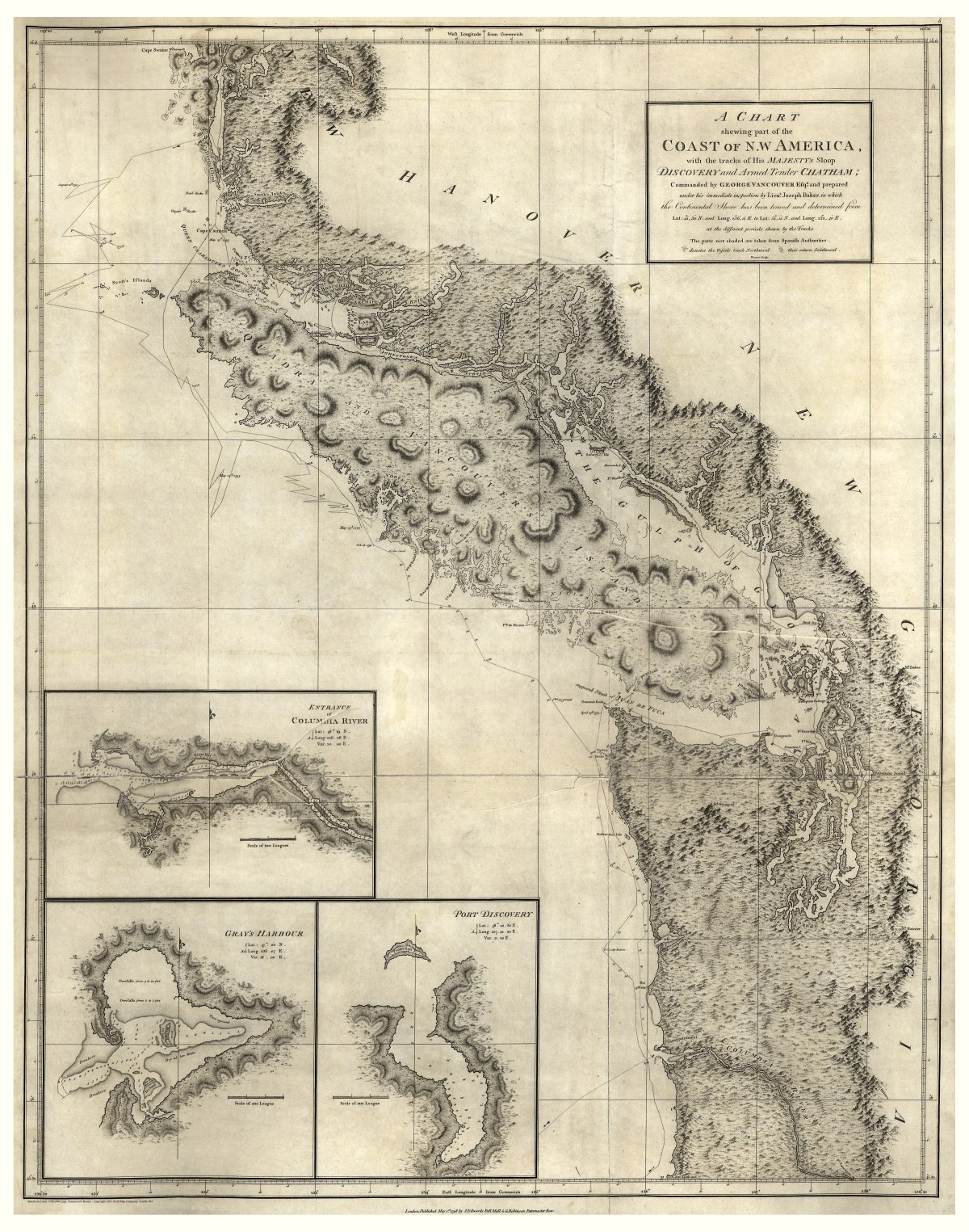
‘A chart shewing [sic] part of the coast of N.W. America : with the tracks of His Majesty’s sloop Discovery and armed tender Chatham’
George Vancouver, Joseph Baker, John Warner, James Edwards, and George Robinson all contributed to the creation and publishing of this map of South Vancouver Island (British Columbia, Canada) and the Washington State coast (U.S.) in 1798. Detailed relief is shown pictorially and by hachures, with insets of the entrance of Columbia River, Gray’s Harbor, and Port Discovery.
Reproduction Size: 28″x 36″