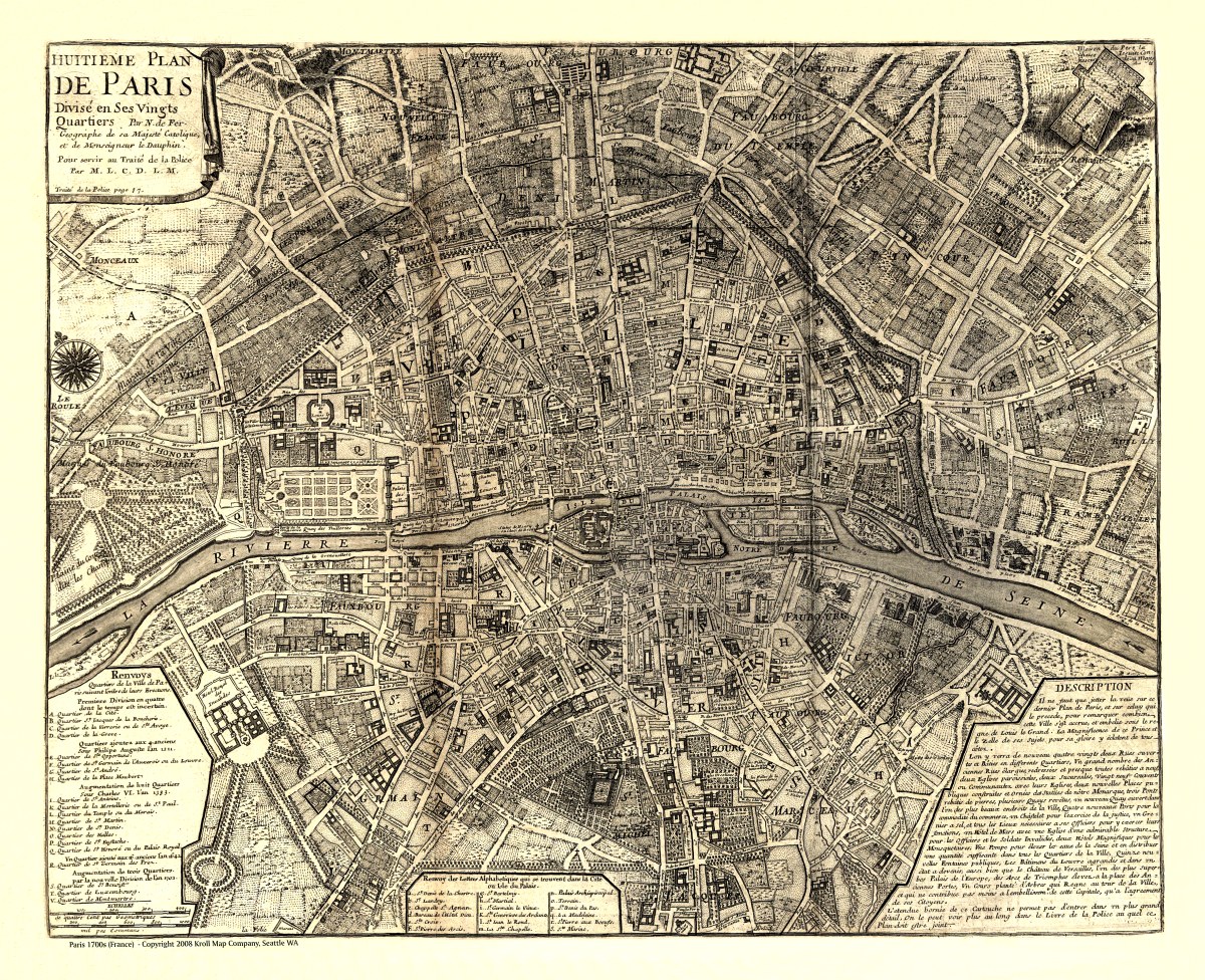
Description
‘Huitieme plan de Paris divisé en ses vingts quartiers’
‘The Eighth Map of Paris dividing into its twenty neighborhoods’. Nicolas de Fer created this beautiful pen-and-ink early map of Paris as it was in 1705 (but drawn in 1715). It was the last in a series of maps that illustrated historical changes and the growth of Paris since the Roman age.
Reproduction Size: 30″x 25″