Description
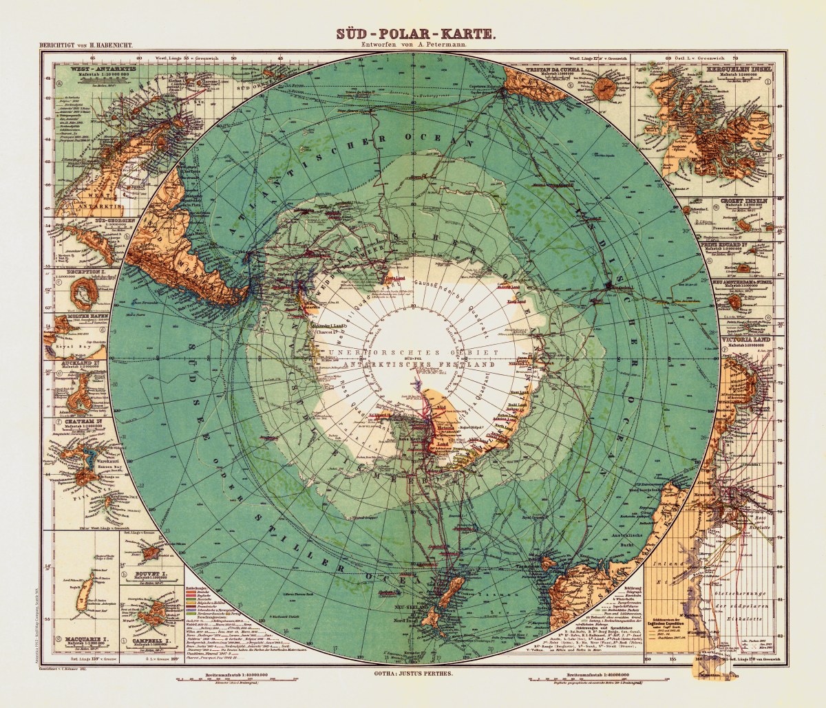
‘Süd-Polar-Karte’
This map was drawn by German cartographer August H. Petermann in 1912. It includes several beautifully drawn insets of islands and bays and a map chart of Antarctica expeditions and their dates.
This antique map of Antarctica or “South Pole Map” was created in 1912 by cartographer August Petermann in 1912. This map is an insert within Stieler’s Hand-Atlas, No. 6. “Süd-Polar-Karte” offers a detailed portrayal of the southern polar region, providing geographical insights into the largely uncharted Antarctic continent. It includes topographic features, coastlines, and geographic coordinates. The map is a valuable historical artifact, shedding light on the understanding of this remote and enigmatic landmass in the early 20th century.
Reproduction Size: 28″x 24″ (71cm x 61cm)