Description
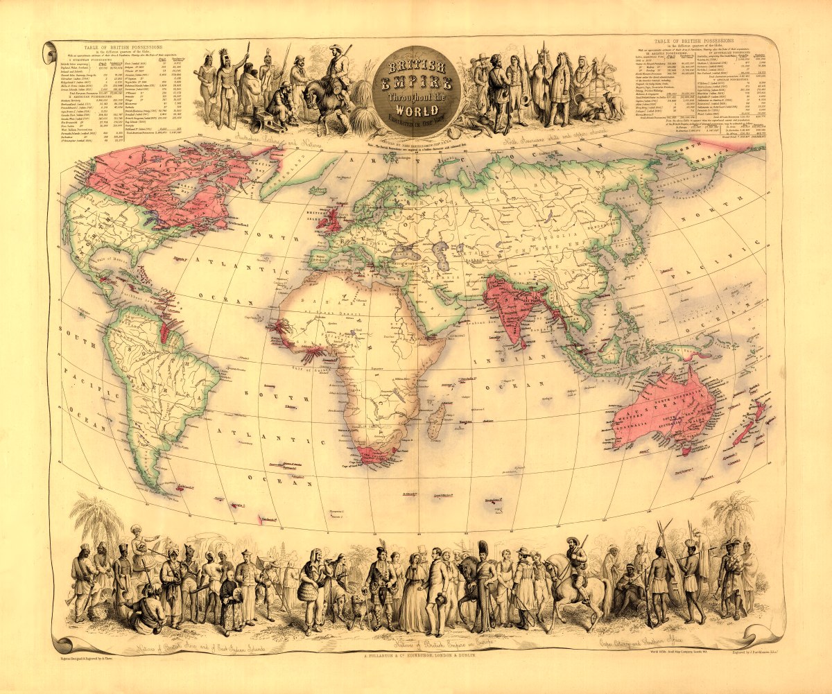
‘British Empire throughout the world exhibited in one view’
Created by John Bartholomew circa 1850s. Note on map: “The British possessions are engraved in a bolder character and coloured red”. Interesting piece of history- there’s a ‘Table of British Possessions’ in the different quarters of the globe with an approximate estimate of their area and population as well as their dates of acquisition [sic]. Several illustrations on the top and bottom borders depict native peoples and settlers in typical dress.
Reproduction Size: 36″x 30″ (91.5cm x 76cm)