Champlain’s Early View of the Northeast Coast
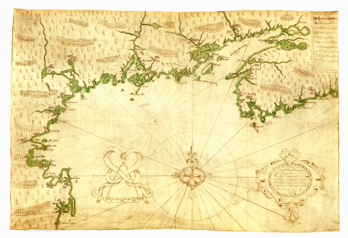
This 1607 Champlain coastal map print captures the northeast American shoreline at an early stage of French exploration. Champlain’s chart is a thorough delineation of the New England and Canadian coast between Cape Sable and Cape Cod, linking the map with his voyages along these waters.
The image combines practical coastal information with a vivid sense of landscape. Soundings appear near the shore, while forests, rivers, and settlements occupy the interior. The green outline draws attention to the intricate coastline, encouraging the viewer to follow bays, islands, and river mouths across the drawing.
A compass rose, dividers, and the long French inscription add the unmistakable character of an early navigational chart. Unlike a modern road map, this composition places the coast and its approaches at the heart of the picture. The details make it an absorbing record of how explorers described a region through which they traveled.
For admirers of maritime history, New England, or early maps of Canada, this reproduction offers both atmosphere and substance. Its warm background and illustrated terrain suit a study or library, where the small coastal features and elegant lettering can be appreciated at close range.
Reproduction size: approximately 36″ × 24.6″