Description
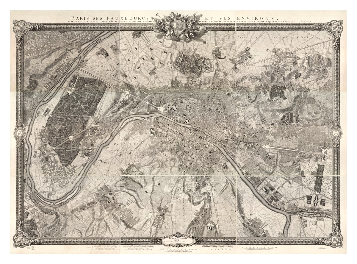
‘Paris, ses fauxbourgs et ses environs : où se trouve le détail des villages, châteaux, gands chemins pavez, et autres, des hauteurs, bois, vignes, terres, et prez, levez géometriquement’
‘Paris, its neighborhoods and its surroundings: the detail of the villages, castles, main roads, and more- heights, woods, vineyards, and lands are shown in relief’. This gorgeous and very detailed map of the Paris metropolitan area was created by Capitaine Roussel in 1731. It is drawn on nine pages pieced together within a decorative frame.
Reproduction Sizes:
24″ x 18″, 36″x 26.6″, 48″x 35.5″