Description
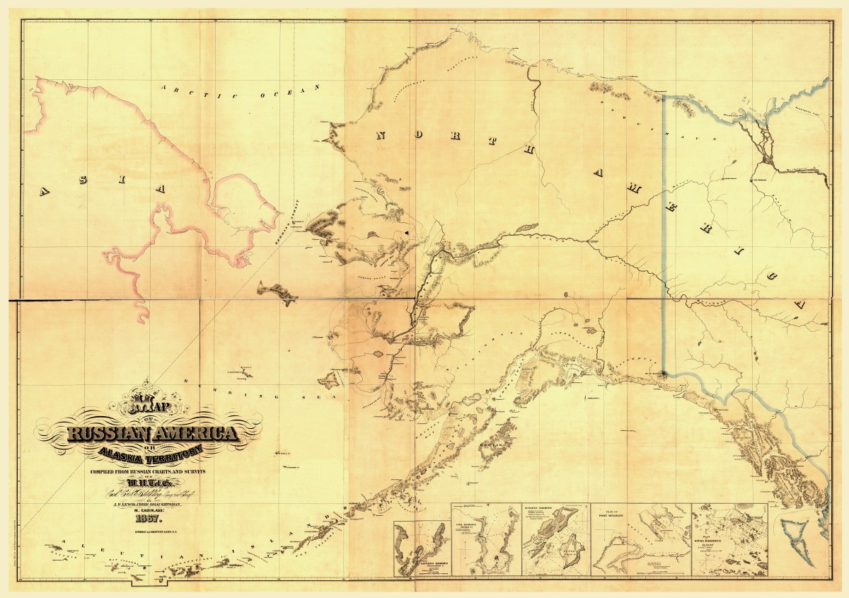
‘Map of Russian America or Alaska Territory’
Imperial Russia sold Alaska to the United States in 1867. Acquisition of the territory was negotiated for the United States by Secretary of State William H. Seward for the bargain price of about two U.S. cents per acre (five cents per hectare). Even though most commentary was highly critical of “Seward’s Folly,” some Americans gradually began to travel to and settle in the new territory. At first they possessed little knowledge of its geography. There thus was a great need for maps and nautical charts to assist Americans in navigating the waterways and trails of this forbidding region. This map, compiled by a draftsman named J.F. Lewis, was based upon Russian charts and surveys mostly commissioned by the Russian Navy. It represented one of the earliest attempts in North America to create an English-language map of Alaska. The main map has no scale, but five inset maps at lower right show local harbors and the scale of each is in nautical miles. The map shows key mountain ranges and bodies of water. Few towns appear, as the Russians had established only a handful of permanent settlements along the Pacific coast.
Reproduction Size: 36″x 25″